 Image taken by Justin Rous on the 2011 Okavango Expedition
Story by:
Steve
There is only so much baking a man can do during lockdown
Expedition testing products is key to all we do at The Safari Store and our founder, Steve, really wants to go on an expedition. It has been two years since our last major expedition called "Three Rivers" which combined the Kafue, Zambezi, and Luangwa rivers in a first-trip-of-its-kind adventure. The only problem is that - as with everyone else - he cannot leave his house except to buy food, fuel, or to get medication.
And so Steve has decided to fulfill a long-standing dream of his to row the length of the Okavango Delta without a local Bayeyi guide to help him find the way: but in the virtual world - from his home. Follow Steve each day as he plans the day's adventure on Google Earth and then rows that section on his rowing machine. The rower is on the deck of his house "as it is the closest thing at home to feeling as though I am in the bush." He will write a trip report at the end of each rowing session to show you where he has been to in his mind on that session, share pictures he has taken in the past from each area (or somewhere close to it), share the map for each session - and let you know of lodges you can visit close to the area where he has rowed so that you are able to dream about going there and start to plan your next safari. It is hoped that this will help to inspire your next trip - or at least take to the internet to find out more about each area - and become the blueprint for a real expedition for Steve in the years to come.
⊙ Skip to: Day 1 | Day 2 | Day 3 | Day 4 | Day 5 | Day 6 | Day 7 | Day 8 | Leg 9 | Leg 10
⊙ Updates are posted on Facebook and Twitter and our handle is @thesafaristore. Please follow us to keep updated.
In the virtual world, there are no hippos to watch out for which is a happy-sad thought all wrapped up in one
Day 1: On the water
Guma Lagoon to Camp 1 located at 18°55'46.98"S, 22°24'38.85"E
Distance rowed: 10.11km. An easy first expedition leg to start burning off the lockdown excesses.
Expected landscape: Guma Lagoon is a large open-water lagoon which is fed by the Taokhe River. On departing the lagoon and going up the Taokhe River, the scenery changes to large, tall, impenetrable stands of papyrus on both sides of the channel. There are only occasional tree islands and it is on one of these that camp would be made for the first night.
Expected wildlife: Hippo along the edge and there are crocodiles in the lagoon. However, the Taokhe River is fairly deep and the papyrus either side is thick with very little hard ground and so I would not expect to see either species in this section. Assumption can be a little dangerous though. Lots of nesting birds in the papyrus and good bird life on and around the lagoon. The launch site, unfortunately, has very little wildlife - if any - and only cows are to be expected. That said, there are elephant in the area during the dry season and the sign of elephant is all around when you drive to the lagoon. Sadly, a good friend of ours lost cattle which drowned in holes made by elephants during the drought last year. While this may become an often-repeated phrase on this virtual expedition: the area is incredibly beautiful and is a good place to explore an off the beaten path part of the Delta.
Lodges or places to stay in this area: Guma Lagoon Camp and Nguma Island Lodge
Images from this area - or areas very similar to it:

Above: Guma Lagoon in 2019. The front of the boat is also the Aliboat I would adapt to use for rowing the real expedition.

Above: The Google Earth screenshot for day 1 of the Virtual Okavango Expedition.

Above: The distance rowed on the Concept2 rower for day 1, leg 1 (14th April 2020).
Day 1 Product Choice:
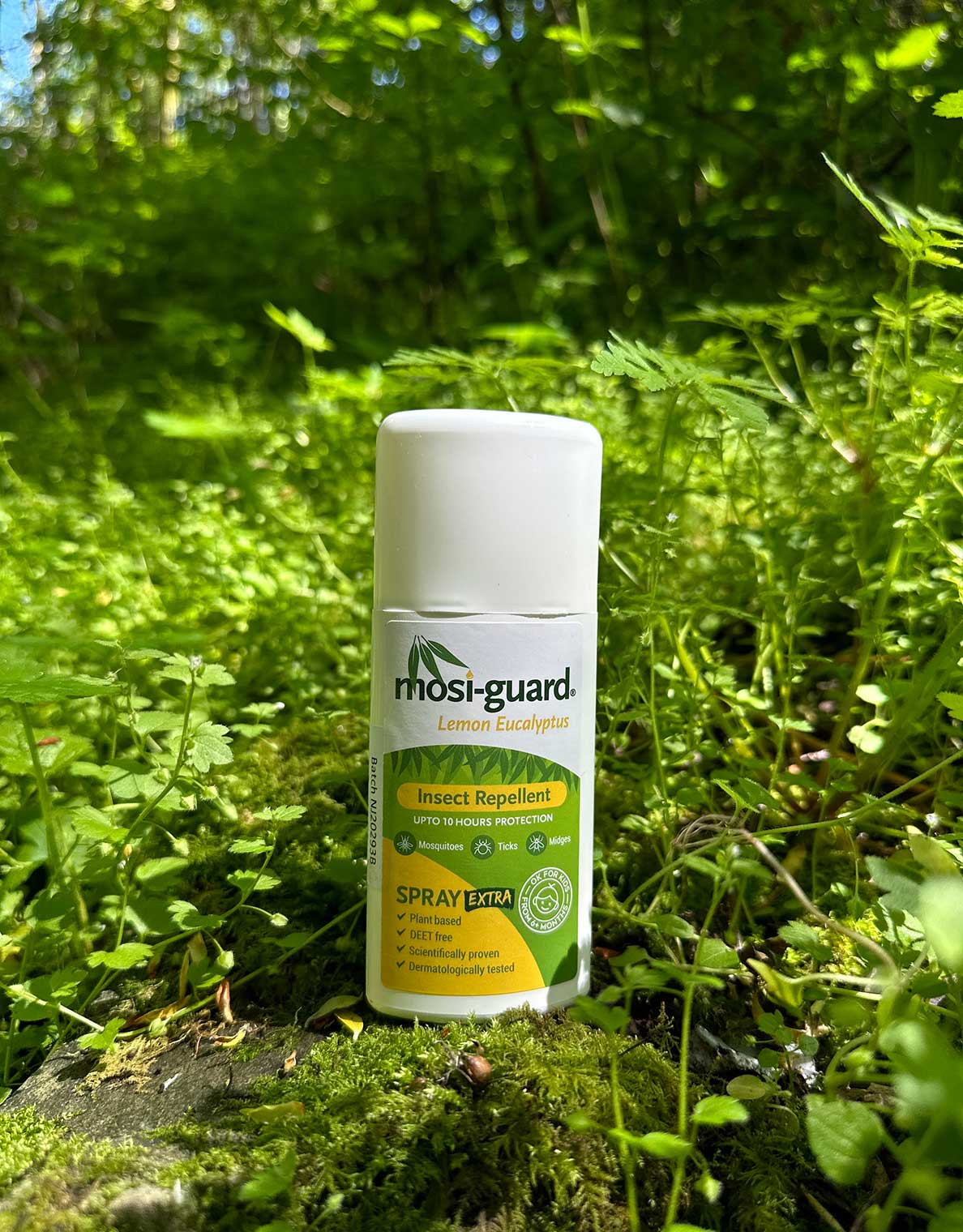
Get protected. Whenever I hear the word "papyrus", I think of mosquitoes. I have been poling mekoros in the Delta down narrow channels in the papyrus and each time I wish I had put on insect repellent. The thick papyrus seems to be the ideal damp, hot environment for mosquitoes. Here it would be no different as, with my hands on the oars, I would not be able to swat the mosquitoes - and flies - away. Without doubt, the first thing I would pack is a bottle of insect repellent. Truth be told, it is usually the first thing I pack whenever I am going outdoors in the summer or on travels - and it is the best repellent available.
Shop Insect Repellent >
While I won't be hearing elephant, fish eagle, and hippo as I row - and lion, leopard, and Scops owls each evening - I will be sleeping in a seriously comfy bed and enjoying hot showers, homemade cappuccinos, and hot bowls of oats after each leg of this virtual expedition.
Day 2: Out of the papyrus and into wonderland
Camp 1 (18°55'46.98"S, 22°24'38.85"E) to Camp 2 (18°52'23.89"S, 22°25'28.77")
Distance rowed: 15.08km.
Expected landscape: Today's row took me out of the russet monotony and hidden secrets of the papyrus beds into the open plains and tree islands which have come to epitomise the world's view of the Okavango's Delta.
Expected wildlife: The concentration of wildlife in the northern Delta is lower than in the central Delta. If the concentration of wildlife in the central Delta was thought of as being the drops of rain during a big Botswanan storm, then the concentration in the north of the Delta is more like the first raindrops which fall and make their mark on the earth. It eases you into wonderland. Here and there, small herds of red lechwe graze, with the occasional lone buffalo bull and small pockets of grey: elephants drifting between the islands. At night, leopard may be heard but they are rarely seen - only the occasional alarm call of monkeys signalling the promise that you may have missed something feline and spotted as you pass through. I would be on the lookout for Sitatunga. The facial features of this elusive and rare antelope seem to be plucked from the pages of The Never Ending Story. There is no other antelope on earth which has such an interesting face. Not beautiful; just interesting. The Gerard Depardieu of the animal world.
Lodges or places to stay in this area: The lodges mentioned in day one are still the best places from which to access this area. Lodges close to Seronga would also be able to show you this area - as are the lodges of the panhandle which would lie in the distance to my left as I enter the main Cubango River. Sepupa Swamp Stop and Nxamaseri come to mind. About 100km upstream also lies a gem of a small lodge called "Askies Bos." The owners - a wonderfully gentle Botswanan family with the soil flowing in their veins - came to our rescue last year when we had car troubles.
Images from this area - or areas very similar to it:

Above: The Taokhe River is a channel through impenetrable walls of papyrus.

Above: About two-thirds of the way through today's row, I remembered that the Jouberts from Great Plains Conservation had kindly shared their masterpiece of an Okavango film with their clients and email subscribers - and so I started to watch it. There is simply no better way to feel as though I was in the Delta and, at one point, I started laughing out aloud with joy while rowing and watching a lioness walking along a channel of the Okavango. The view of this elephant bull is exactly how it would look from the water. If you have not watched the three-part "Okavango: River of Dreams", then please do find a copy and watch it. It is the best film of the Delta I have seen.

Above: This map shows the leg rowed on day 2 of the Virtual Okavango Delta Expedition. The blue waypoint markers are from the 2011 Okavango Expedition.

Above: The distance rowed on the Concept2 rower for day 2, leg 2 (15th April 2020).
Day 2 Product Choice:
Remember that adage about Africa having "big" skies? Well, that is certainly true of Botswana - or at least it is so flat that it feels that way. There is something which tends to be hanging in the middle of that sky at midday which can burn you pretty badly if you are not careful: the sun. Botswana has record numbers of sunny days, which I guess is part of the appeal for folks from the northern hemisphere - amazing wildlife and people aside. And so my product choice for today is a hat. The choice for me is between the Rufiji™ Explorer Canvas Safari Hat and the Rufiji™ Explorer Leather Safari Hat. Both are unisex and uniquely adjustable but, as the image below is of me rowing an inflatable boat on the Three Rivers Expedition - and as I am wearing the first prototype of the leather hat - that is what I am going to go for to protect me from the sun.
Shop Rufiji™ Leather Explorer Safari Hat for Men & Women >

Take the time to listen to the distant grunt of hippos: the double bass in Africa's morning orchestra of sounds.
Day 3: Exploring like an Italian and "Taking the time"
Camp 2 (18°52'23.89"S, 22°25'28.77") to Camp 3 (18°53'6.94"S, 22°28'5.34"E)
Distance rowed: 11.50km.
Expected landscape & wildlife: Pretty much the same as yesterday, but this section of the main channel of the Cubango River has lots of tall reeds and fewer open areas and less islands of trees and termite mounds. Beyond the channel, however, lies hidden lagoons with all the wonders that each holds, closeted away from the world by a curtain of tall grass and dangling sedges.
But that is not what I thought about most today as I rowed. The past expeditions have had real time pressure and lots of "we must get on the water at first light" kind of talk around the campfire at night. Each night is usually early to bed after 8 to 10 hours of hard slog. Anyone who has done an expedition would be lying if they told you that they loved "all of it, every second - promise". There are simply times when it is 'crap' - there is no better word for it. Just crap. Anyway, so I realised today that I would apply something I took away from my last trip to Italy. I love the Italian way of life, their approach to every day. They are the Africans of Europe and they live by an Italian version of African time - days dotted with cappuccinos enjoyed in restaurants, rather than taken away. Italians know how to take the time to slow down and enjoy life. And so that is what I am going to do on the next adventure in Africa: take the time. This morning I imagined that I woke up just before sunrise, but only to stoke the fire and put some coffee on, before finding a termite mound to sit on to watch the sunrise and listen to the distant grunt of hippos: the double bass in Africa's morning orchestra of sounds. I would probably then go for a walk, throw a line in the water (although I get too impatient with fishing, unless I am drifting down the Zambezi with a beer in my hand, good company - and elephant on the banks). It would be a morning of late breakfasts, maybe some birding, before slowly packing up and getting on the water to drift downstream over lunch. I would stir the water with my oars to keep the boat straight - much as one would slowly stir a pot of porridge over an open flame. As the day cooled I would then start to row with a little more gusto. Sadly, that is all in my mind. This morning was spent knee deep in accounts and learning a new system; more through necessity than desire. What was it that was said about necessity?
Lodges or places to stay in this area: This area is a no-man's-land between places. The lodges of Xau Island, Pepere, and Kadizora are ones to pass later on in the trip - around a few more snake-like bends. Perhaps tomorrow.
Images from this area - or areas very similar to it:

Above: Taking the time to enjoy a campfire and food cooked over open flame in 2011 in the Okavango.

Above: This map shows the leg rowed on day 3 of the Virtual Okavango Delta Expedition. The blue waypoint markers are from the 2011 Okavango Expedition.

Above: The distance rowed on the Concept2 rower for day 3, leg 3 (16th April 2020).
Day 3 Product Choice:
On Day 1, I chose a product to help me avoid insect bites and, on Day 2, I chose a product for sun protection. For today's product, I am going to select a product which will offer me an extra layer of sun and insect protection: the BUGTech™ Everything shirt. It is simple in design but loaded with features built into the fabric. It also has roll-up sleeve tabs to allow me to roll my sleeves up or down when cold or hot or as the sun burns my arms - and it offers UPF50+ sun protection and a high level of world class insect defence through the BUGTech™ finish on the fabric. While it is easy to dip the shirt into the Delta water to wash it, the anti-microbial nature of the fabric means that I won't have to wash it as often as, say, a cotton shirt. This shirt is available in a men's and a women's design and is secretly my favourite in the range as it combines outdoor performance with safari style.
Shop Men's Everything Shirt >Shop Women's Everything Shirt >
Day 4: The best tasting whisky in the world - is any single malt with winter-cold Delta water
Camp 3 (18°53'6.94"S, 22°28'5.34"E) to Camp 4 (18°53'6.94"S, 22°28'5.34"E)
Distance rowed: 10.14km.
Expected landscape & wildlife: I rowed into the evening today and, as the sun set, I thought about the vast swathes of plant life in the Delta which line this section of the main Cubango River. It was that thought which led me to thinking about whisky and just how incredible a Delta whisky would taste right about now. This is a real world case of "no filter required": the hundreds of kilometres of reeds seem to do the trick at producing some of the purest water on the planet. Of course, the purpose is not to make clean water for whisky but, in filtering out the water, the plants are trapping sediment which has drifted down the river from seasonal floodplains further upstream in Botswana, Namibia, and Angola. This sediment not only starts to form islands where it is trapped against termite mounds and trees growing on termite mounds - but also feeds the entire system. If nothing else, that makes a Delta whisky taste just that little bit sweeter and smokier. The Delta has earned it for you.
Lodges or places to stay in this area: The thick reed beds and low-lying ground mean that there are no lodges along the channel - yet. The lodge on Xau Island is to the north of where I rowed today (I seem to recall that it is called "Distant Echo" or something along those lines). Pepere island with Kadizora behind it (which joins with the well-known Vumbura peninsula) will be close to where I row tomorrow.
Images from this area - or areas very similar to it:

Above: The near total lockdown in South Africa means that drifting across Delta waters - and drinking a fine whisky tonight - are simply not possible at the moment.

Above: The map showing where I would have rowed on day 4.

Above: The distance rowed on the Concept2 rower for day 4, leg 4 (17th April 2020).
Day 4 Product Choice:
Ever heard of "rock, paper, scissors"? On rivers in Africa, it is more like "rock, hippos, or croc?" Finding out early can be the difference between ending up on an island as your boat sinks in the channel behind - or, even worse, taking a swim in a dark, deep Delta channel. A good pair of binoculars is usually the only tool on your boat which will help you answer the "rock, hippos, or croc" question. While I am yet to see any rocks in the Delta as it is in essence a big basket of sand, early warning of a grumpy hippo bull hiding in the water under the shade of an overhanging tree is invaluable. Swimming with crocs is not my idea of fun and neither is meeting my second hippo face to face from a boat. Given any choice of optics, I would select the Swarovki EL 10x42. Sadly, I lost mine somewhere in Mudumu National Park after leaving them on top of my car at a sundowner stop. I was not best pleased with myself as they were my most prized non-Safari-Store-brand possession. They are also quite simply amazing for birding, game-viewing, star-gazing - and you can even take images through them.
Shop Swarovski™ Binoculars >

Game trails are like spun silk connecting places only humans have named
Day 5: A weekend of memories of exploring the delta- and then 17km on the water
Camp 4 (18°53'6.94"S, 22°28'5.34"E) to Camp 5 (18°59'16.50"S, 22°34'27.03"E)
Distance rowed: 17km.
Expected landscape & wildlife: I decided to take it easy over the weekend - and, in the virtual world, I hope that I would have done the same. With day 4's camp just upstream of the channel to the lagoon in front of Pepere, I think I would have spent the weekend trying to find the hidden islands and untouched areas of the western end of what I call the Kadizora peninsula. This is an area I spent two nights camping with EB, who also taught me how to pole a mokoro. It was a blissful "recce" trip and was part of one of the best southern African adventures I have done with my parents. We drove a VW Golf all the way from South Africa to the Okavango and then did a big round trip through the Caprivi Strip and back down to South Africa. The little Golf had its fair share of adventure too as - at one part of the trip - it was left at Sepupa lodge just in time for the annual flood to arrive and cut off the only exit from Sepupa to the mainland. The VW had to be towed by a Land Cruiser through the rising waters of the rather aptly named "floodplain." Remarkably, it made it through unscathed and dry.
I have decided to include some images below which tweaked my memories of the trip and some of the wildlife encountered on walks with EB in the middle of nowhere. One of my favourite moments was learning that, if we had carried on walking east for a few days, then we would get to Vumbura - and the dry areas of Selinda, Savute, and Linyanti beyond. Game trails are like spun silk connecting places only humans have named - and are wonderful paths to follow - if with some caution.
Lodges or places to stay in this area: Back to the area through which I would have rowed on day 5. This day marks the longest distance I have rowed to date in the virtual expedition, bringing the total kilometres in a week to about 63km. As above, I would have passed the channel to Pepere Island, which is run by Sepupa camp at the moment as an affordable place for overlanders. I believe that there are talks and murmurs of a partnership with Great Plains of Duba Plains fame and the creation of a luxury lodge. Talking of Duba, I would also have rowed past the eastern edge of an island which I "discovered" while mapping last year and which is also known as "little Duba" and is home to Setari Lodge. To the south-east lies Duba Plains itself, which is well-known for big herds of buffalo and "swamp cats" - lions which have learned to hunt buffalo and lechwe in this watery wilderness. It is exciting to feel as though I am entering the core of the Okavango Delta. I rowed without mapping today and it was also fun to find that camp 5 is located at the main split in the Okavango River. Tomorrow I will take the western fork and start to close in on that most famous of Botswanan wildlife landmarks: Chiefs Island.
Images from this area - or areas very similar to it:

Above:The first time I saw a Jacana nest - hidden in plain sight.

Above: Is there a better way - or place - to eat dinner? As the sunsets and it gets coal-black-dark you do start to take a wary look over your shoulder every few minutes.

Above: Crystal clear April delta skies - filtered by months of rain.

Above: Walking out. A few scrapes and bruises on the legs from sharp reeds, tired, but oh so happy.

Above: On walks in the north eastern delta you got the distinct impression that the game did not see too many humans. How wonderful.

Above: If smiles speak of a thousand unspoken words. Perhaps there should be no such phrase as "a forced smile" - as it simply is not a smile. My parents Mart and Hazel (aka Chuck and Nancy when we travel) loving the boat ride back to Sepupa - where the car was under threat of becoming a fresh water reef for bream and tiger fish.

Above: The map showing where I would have rowed on day 5. Setari is the island just above the camp 5 marker pin. Duba plains is the area to the south east (right and down a bit).

Above: The distance rowed on the Concept2 rower for day 5, leg 5 (20th April 2020).
Day 5 Product Choice:
If there is one thing which always surprises me about the Delta it is how cold it can be at night - especially from April through to August; even into September. Landlocked and at about 1000 meters above sea level - and on a base of sand - it behaves like the flooded desert which it really is. With the prospect of evenings spent close to the cool waters - and with snug, warm nights the aim as nights turn cold and even giant reptiles are forced to slow down - I would definitely take a fleece on this trip. The key to my choice lies in the word "snug" - and there is no fleece more snug than the Men's and Women's SafariElite Bonded fleeces. I wear mine at home on cold nights and cool mornings - and on ski trips or short breaks into the back country of the high mountains of Africa and Europe.
Shop Men's Bonded Fleece >Shop Women's Bonded Fleece >
...lines on maps which don't seem to shift as the Delta adjusts its seat on the tectonic plates beneath
Day 6: The obvious way is very often not the way.
Camp 5 (18°59'16.50"S, 22°34'27.03"E) to Camp 6 (19° 2'12.94"S, 22°33'40.03"E)
Distance rowed: 10km.
Expected landscape & wildlife: Today's row would be pretty exciting in the real world - on the Okavango River - as it follows the riverine boundary of the Moremi Game Reserve. There is nothing on the ground to separate one manmade area from the other in this wilderness - they are only lines on maps which don't seem to shift as the Delta adjusts its seat on the tectonic plates beneath. Camped just south-east of Setari Island on a question-mark-shaped spit of land, I would have woken knowing that today I would leave the safety of the wider channel to sneak my way west along a much smaller channel. This is something which always takes me by surprise in the Okavango Delta. A large channel which looks a delight to paddle may end in a blocked section of papyrus with no way through for anything larger than a black crake. Big pods of hippo cause blockages too just by being there. It is always baffling then to be shown - by Bayeyi fisherman and friends - the way to go. And it is never obvious. A 50cm-wide path made by hippos through thick grass with just enough water to float a dugout canoe - and which skirts the drooping fronds of wild date palms on small islands - simply does not seem like a common sense route. But the Delta is a maze. And the links between open water would make Robert Frost very happy. They aren't roads less travelled, but roads never travelled - apart from by the hippos which made them. In many ways, the Delta is also a large spiderweb, with leaves caught midair from the breeze. The web lines itself are these hippo paths; the leaves the open water and lagoon. If you get lost, it can be just as dangerous as it is for an insect stuck in a spider's web.
From a wildlife perspective, much of Day 6 travels through thousands of acres of flooded reed beds - and so, apart from hippo and elephant, I would not expect to see much other big game. In mapping the day, I started to worry that there would be nowhere to camp. I knew that I wanted to row 10 kilometres and it was only at 9.5kms that I - thankfully - saw an island on the Google Earth horizon. It was amazing to feel - somewhere deep in my stomach - that same feeling of being on the water as the sun is setting with no obvious place to make a camp. I have had this before on the Kafue with Claire; and on the Zambezi on the expedition with Brent. It is not a nice feeling. Panic creeps in slowly like mist on the sea.
This island is a small, lightly wooded spit of land and is located north-east of Jao Island. Jao is where EB and his brother Galle were born before their father took them to Ethsa on the western edge of the Delta. In looking at the island on which Camp 6 would be located, I wondered whether or not EB and Galle came here to fish - and also what would lurk in the shadows of the mangosteens, figs, and jackalberries. I wondered, too, how much land it takes to enable the big cats to stay in an area - and if I would hear lions and leopard in the distance from larger island.
Lodges or places to stay in this area: Jedibe camp used to be in the area close to Jao island - but that shut down over a decade ago. The remote location in the depths of the Delta made it a very hard camp to re-supply, get guests to, and limited the activities on offer to only water-based ones. I find it a bit sad that as I have always loved the word "Jedibe" - but it does mean that the heart of the delta is getting to rest. Rather strangely, the camp called "Jao" isn't anywhere close to Jao Island - they only share the name. If you wanted to get into this area, then the best lodge would still be Setari as it is just off this main channel.
Images from this area - or areas very similar to it:

Above: The obvious way should be the wide open lagoons.

Above: But often the wide open lagoons are not the way. This shows what the link in the watery chain of the delta usually looks like. They are painfully slow to navigate and it can be hard work pushing heavy, long boats through tight bends. They are also incredibly beautiful links, when you take a moment to drink some water and take it all in.

Above: The map showing where I would have rowed on day 6.

Above: The distance rowed on the Concept2 rower for day 6, leg 6 (21st April 2020).
Day 6 Product Choice:
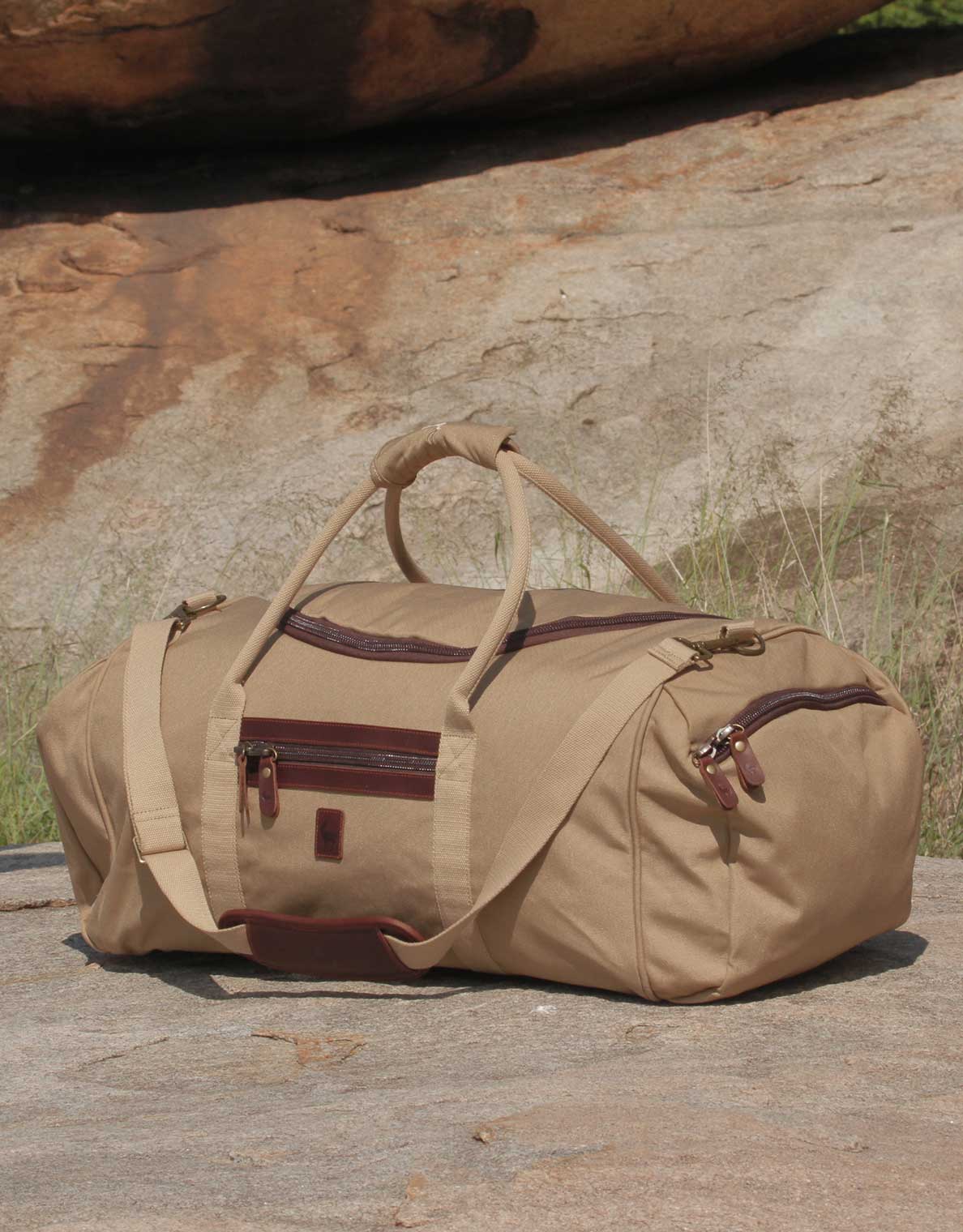
My Aliboat is a dry boat (when it does not rain) and, as I would have lots of gear, I would pack it all into one of our soft, squashable, strong safari duffel bags. In classic canvas and leather, our duffels are a hit with our clients and is a true statement of the simpler side of refined safari style. With a horseshoe-shaped zip for easy access to things even packed at the bottom of the duffel and other practical features, this is the best travel bag for any kind of safari.
Shop the Safari Duffle Bags >
Day 7: The poor man's houseboat.
Camp 6 (19° 2'12.94"S, 22°33'40.03"E) to Camp 7 (19°6'48.78"S, 22°34'40.83"E)
Distance rowed: 12km.
Expected landscape & wildlife: I have jokingly pitched a tent on a small boat in my driveway at home - to make what I call a poor man's houseboat. With all the things that can go bump in the night - and eyes which shine like jade pearls in the darkness - I would prefer to never sleep on the water. For Camp 7, that is exactly what will need to happen as there are no islands in sight for miles to come. I am not sure what would worry me more: clouds of mosquitos dropping like vultures into the boat to feed; 5-metre crocodiles coming to investigate the boat - the all-too-real mythical beasts which would be top and tail longer than the 3.6-metre boat (and maybe wider too); or the straggler hippo bull irately bumping his way upstream - hoping beyond all hope for a fight with anything. It would be a long night.
From a wildlife perspective, much of Day 7 is the same as Day 6 with reed-beds and blankets of green and rusted-red papyrus - the shitenge or kikoy into which the nether regions of the Delta is wrapped. These are the nesting areas for thousands of birds and, as I sit here, I can just about hear the morning chorus as I start to row. Black-necked herons perch precariously on the rotten-plant-matter islands. Without tree islands, fish eagles use the fingers of dead trees washed done by floods over the ages - and even clumps of papyrus - to perch and watch out for fish and any other easy meal on offer. Everywhere you look in the Delta - no matter how remote or devoid of land - life is thriving. It is a place bursting at the seams with what these days - in a man-dominated planet - may seem to be an overflow, an excess. My guess is that it should just be the norm.
Lodges or places to stay in this area: You will see on Google Earth where it says "Google" a blunt arrow of land starting to appear. That is Chief's Island on which there are numerous seriously expensive lodges - but we are not quite there yet. The closest lodge is no longer Setari, which is now a few hours away of Delta-slalom-turns by power boat to the north. The closest lodges are Tubu Tree, tucked away in a magical - kind-of forgotten - part of the Delta to the south-west; and then Kwetsani, Jao, Jacana, and Pelo pretty much directly south of Camp 7. These are mostly "wet camps" with very little dry land on which to game view - and, as a result, activities are focussed on what you can see from the water. Even with less wildlife, there is something so peaceful about going by mokoro or Aliboat to a small island for a walk and a picnic. Often, these small islands serve us some surprises of the large pachyderm persuasion - so best to keep an ear out for the sound of a broken branch or palm-nuts falling to the ground as elephants turn 10-metre tall Hyphaene palms into whips to shake the fruit from the upper fronds.
Images:

Above: The poor man's houseboat.

Above: The map showing where I would have rowed on day 7.

Above: The distance rowed on the Concept2 rower for day 7, leg 7 (22nd April 2020).
Day 7 Product Choice:
A very easy choice today: something to stay warm while sleeping on the boat. I would definitely need a beanie tonight to keep my head warm. The great thing about our Thusk™ range is that the story behind the making of Thusk™ knitwear will leave you feeling warm inside too. They are knitted by Zulu grandmothers in South Africa are a crucial source of additional income for them and their families. I have also worn my Thusk™ beanie everywhere from on safari to the Savoie Alps and the pure South African wool works well to keep you warm, while looking (and feeling) good too. The person wearing a Thusk™ beanie in the snow below is me in Valloire in France.
Shop the Thusk™ range >

Day 8: Orinoco no-flow & walking where there should be water.
Camp 7 (19°6'48.78"S, 22°34'40.83"E) to Camp 8 (19° 8'35.64"S, 22°37'42.37"E)
Distance rowed: 10.8km.
Expected landscape & wildlife: Over the past few years, the Okavango Delta has been much drier than in the past and the big floods simply have not happened. To illustrate the point, in 2011 we only had to push our mekoros over one stretch of dry floodplain - and that was across a low termite-mound-island which I think is always dry. Last year, in 2019 - on a shorter mekoro trip - we went walking on a large island which we had poled across through knee-deep waters in 2011, and the Okavango River did not flow at all down the Boro channel to Maun in 2019. In 2011, we floated into town. In 2019, we would have had to walk the last 30 or 40 kilometres and many water-based activities which run from the camps in Maun had to include a long game drive to find water. This completely shifted the movement of wildlife and the livelihood of people who rely on work as mekoro polers and are usually based at the poling station at the start of the Boro channel. No water meant no jobs as the poling station moved to another community - who usually do not have a poling station - and so the tourists and the jobs shifted. Lucky for some, unlucky for others.
Today, while mapping, I noticed that, even further up the Okavango River, the entire channel was blocked by papyrus. Without the usual strong flow of water to keep the channel clear, it has simply blocked. I say "usual" - but I know that, as humans, we think of low rain years as an anomaly, when really they are part of a greater cycle which has played out for longer than living memory. The Okavango is ancient and has shifted and shuffled over a timespan we cannot comprehend.
It was my hope today - as I mapped the route - that, in a high-water year such as this year, I would not spend days and days trying to cut my way through metres of papyrus. The papyrus I hope would be flushed downstream by the power of the main current - perhaps with teams of hippo and elephant volunteers providing some extra muscle. If I had to try cut through, then it would be back-breaking work and I think I would have had to rather back-paddle and try find a way around the blockage further upstream. At the back of my mind - if I was left with no choice but to cut my way through - I can assure you that I would be wondering whether each stem or log was not a mamba or crocodile. Also, Enya's song 'Orinoco Flow', which I may have been humming while cutting, would definitely have had to change to Orinoco No-Flow.
As an aside, if you find the camp location on Google Maps, you will see that the island I camped on looks a lot like a fish hook. Perhaps an expedition from Fish Hoek in the Cape to Fish Hook in the Delta is an idea for my brother who lives in the Cape. I can help him with the Fish Hook part - although a pan of calamari at Champman's Peak Hotel would not be left uneaten today. In fact, it would have no threat of going cold.
Lodges or places to stay in this area: Kwetsani, Jao, Jacana, and Pelo are a little bit closer today. I am not sure if there are channels connecting their lagoons and bleached islands to the main river. In many ways, I see those lagoons and small islands with egret-white centres in the same way as the bai I read about in Michael Fay's enigmatic adventure through the rain forests of Gabon. Bai is a pygmy word for forest clearings where you will often find forest elephant, gorillas, and other birds and animals congregating. I know there is usually water there too and the reasons for animals being there are more practical but, to me, it is their demilitarised, neutral ground where no one tries to eat anyone or cause a fight - as everyone is there just to relax and escape the claustrophobia and cloying heat of the deep forest. The equatorial animal equivalent of a family beach holiday, without ice cream. After miles of deep reeds and annoyingly steadfast papyrus, open lagoons and islands make you feel as though you can relax and stretch it out a bit. As an aside, I am not sure what causes the "egret-white" Delta island centres which have no vegetation in the middle and the sand is white and crusted - perhaps high salt levels?
Images:

Above: Walking where there should be water. We found a wild dog kill to the right of the island in front of me - in that gap.

Above: The map showing where I would have rowed on day 8.

Above: The distance rowed on the Concept2 rower for day 8, leg 8 (23rd April 2020).
Day 8 Product Choice:
In case you have missed it: it gets cold in the Delta. I would definitely pack trousers with some stretch, which will be needed for rowing in the mornings. I have chosen the Savute trousers shown in the image above as they really are super comfy to wear and have good sized pockets for insect repellent, small books, and so on. The women's equivalent are called the Serengeti Joggers and they also have stretch.
Shop Men's Savute Trousers >Shop Women's Serengeti Trousers >
Leg 9: Silver ribbons where sand & water meet
Camp 8 (19° 8'35.64"S, 22°37'42.37"E) to Camp 9 (19°21'19.01"S, 22°47'28.27"E)
19°21'19.01"S 22°47'28.27"ELeg 9 Distance rowed: 50.04km
Total Distance rowed: 146.67km
Field Report: Leg 9 has been the longest section of the expedition so far as I have concentrated on rowing and mapping rather than regular daily updates on social media and on the trip report page. The further into the Delta I have rowed - and the more I have explored using Google Earth - the deeper the feeling I have of one certainty: I would probably get lost. The labyrinth of Delta channels remind me of what happens when you first tap on a hard-boiled egg. If you imagine that each small fissure in the egg's shell is a tiny channel in the Delta, then you start to understand how easy it could would to get lost. Sometimes there is more than one way. Other times, you wonder if the channel which you are following is the best way or if, during the flood, channels appear where there simply aren’t any during the drier times. The Delta is a giant puzzle where you have no option but to start at the edges and work your way inward.
But puzzles - our cardboard mazes of the table - have one distinct advantage: they are human-made, have structure, and work to a plan. The Delta does not. It goes where the sands and gravity allow - it trickles water into slices made by the random wandering of generations of elephant and hippo. It is almost as though elephant here are followed by silver ribbons of water which are attached to their hind legs and go wherever they go.
It is a wonder to behold the Delta from above - whether in a plane or on a satellite image. The small islands start to resemble roughly made croutons in a pea green soup. As I rowed - and mapped where I was rowing on Leg 9 - I searched for signs of humans: small villages - the fishing outposts of the BaYei - and luxury lodges. The lodges are easier to spot. In a world of no straight lines, the ruler-straight lines of airstrips dot across the Delta. They resemble ceremonial scars on a warrior's body, cut by a giant knife across the skin of the Delta.
Over the length of the Leg 9 row, the Delta has started to transform herself. As the main channel slows, the dense papyrus gives way to vast open areas and starts to puddle into large lagoons. The waters of the river begin to stretch out - a lion stretching before the hunt. And wildlife flourishes. To the east lies Moremi Game Reserve and the legendary shield-shaped dry land area called Chief's Island. On Chief's, there are many lions stretching to hunt - it is a distillation of miles of sparsely populated flooded Kalahari - and the concentration of game borders on the intense. Anywhere - across the swathe of the Kalahari Desert - where sand meets water - life flourishes. Here, large herds of buffalo, lechwe, and plains game congregate - and where you gets lots of game, you get lots of predators. This is the domain of wild dog, leopard, hyena, and lion. Fenced in by the Delta waters, they have no other choice but to interact and these clashes, in turn, have attracted safari-goers and filmmakers to what is perhaps the best game-viewing area in Africa. Where water and sand meet, humans meet the wild.
Lodges: The lodges here are some of the best safari lodges in Africa - and the most expensive. Their prime position at this juncture of sand and water means that they are able to charge the highest prices in Africa. Ironically - as Chief's Island is located within the Moremi Game Reserve which prohibits walking and night driving - the activities are limited to game drives and mokoro trips, but it is the promise of National Geographic standard game viewing which draws guests with deep pockets. Plus - I am sure - it is worth the dinner table boast of “Darling, you simply have to go to Mombo; it’s fantastic and worth every dime.”
Chief's Camp and the two Mombos are ideally situated to explore this island which is named in honour of Chief Moremi - the namesake of the game reserve itself. Part of me does wish, as I row past, that I could add a Mombo boast to dinnertime conversations. For me, nothing beats a simple tent under a tree with Claire - lost in the bush somewhere. But of course I would say that.

Above: Updated position on Google Earth. Camp 9 is just under 150km from the start of the virtual expedition.

Above: Here I am rowing on our last expedition called Three Rivers. Trip report on that to follow soon. This section is through Mpata Gorge on the Zambezi river
Leg 10: How fish eagles really fish
Camp 9 (19°21'19.01"S, 22°47'28.27"E) to Camp 10 (19°45'22.66"S, 23°14'57.09"E)
Leg 10 distance rowed: 107.03 km
Total distance rowed: 253.7 km
Field Report: Leg 10 has been intriguing for a number of reasons. First off, it has been amazing to see how intensely the main channel is criss-crossed by animal trails with the wider crossing points made by elephant very evident the further south I rowed. The river here is bordered by Chief's Island in the east and myriad large islands to the west - and it is perhaps no surprise then that there is a high concentration of wildlife located here. Remarkably, I also saw a herd of elephant and a herd of buffalo close to one of the crossing points on the satellite image - which is a first for me.
Therefore, I am sure that, on this section of river, I would frequently make way, with a slight bow, to the largest of earth's pachyderms: elephant. You do not need to be humble to bow before an elephant. They really are big in every way: character, body, the role they play in romantic memories of Africa - usually silhouetted or as grey ghost ships sailing quietly through the morning mists which are common in this area - and the elephant-sized impact they have on the environment through which they pass. The cliches abound about elephant within any ecosystem, but my favourite is the reference to elephants as being the "gardeners of Eden." They are true geniuses of the botanical world and achieve this gardening completely just by 'being' - it is all completely subconscious or unbeknown to them, which I guess is what nature does best. Even with our cognitive abilities, this is something which no great Kew gardener, nor contributor to the Chelsea Flower Show, can come close to achieving. Of course, elephants have time on their side and they only need to use their great grey multi-tools - their trunks - once every few years in an area to tend to their watery gardens. Isn't the thought that elephants garden without knowing it a wonderful thought?
Perhaps the most surprising thing I noticed - while I was mapping the last section for the last day of rowing - was that the water over which I had rowed that day was not white from the reflection of the sun, but it was pure white as it was no longer there. I had not been rowing down the channel but across the white Kalahari sands which make up the bottom of the usually clear and deep main channel of the river. It took me by surprise. In looking at the date on the Google Earth map - August 2019 - I realised that, while there definitely should have been water there at that time of year, the bottom of the channel had regressed to form a thin strip of dry desert. In fact, the entire Okavango had transformed from a watery wilderness into looking more like a vast open plain dotted with the last remaining waterholes located in the deeper pools of the main channel - and, again, there are signs of wildlife everywhere. It must have been pretty incredible to walk where once there was water for those on the ground last year. This is both incredible and worrying - although I think, as humans, we overestimate and rely too heavily on Mother Earth always being the same, but she quite simply never really is. Droughts, floods, times of plenty, and barren patches all play a part in a much longer game which nature is playing - and one which is way past our reckoning and experience. As with the elephant gardeners, the fact that we have very little control over climate and rain actually makes me smile as we really do - as humans - overestimate how much we can control. That feeling that I have no control at all comes with a certain feeling of freedom too. It is the same feeling as seeing a dark night sky without aircraft or a plain without any roads or lights at night. It is what I miss right about now - and in fleeting memories which come to me for no apparent reason - snippets of wild places.
Which brings me to fish eagles and fishing. I think that fish eagles have to be the most commonly listed species on marketing bumpf by lodges across Africa. Their call has become one of the safari world props - a call which says "you are in Africa and you are on safari". I would add the sounds of lion, leopard, and hyena at night; the low rumble of elephant through a thicket, and the fiery-necked nightjar call as my favourite other safari cliches. To hear them is to know that you are a decent depth inside a wild area.
You will have seen - or taken - the classic fish eagle photograph or video. With claws outstretched, the eagle is seen to pluck the fish from the surface of the water before flying off to eat the fish from a nearby perch. It makes for a spectacular image. Usually, though, it is taken as a result of a little bit of a conjurer's trick by safari guides. First a bream is caught; then it is gutted and the guts are replaced by straw to make the fish buoyant. Finally, it is thrown into the water within sight of a pair of fish eagles. It is then just a question of keeping your camera focused on the floating fish and snapping the perfect photo as the fish eagle takes the fish. I have taken that exact photo in Pamushana in Zimbabwe. At first, the eagle thought about whether or not to go for the fish for about half an hour. After one unsuccessful fly-by, it nabbed the bream - and, while the bream's days ended less than well, the fish eagle fed on the bream and I had the image I was after. It is a bit contrived though.
It was while walking was on the banks of the Kwando Delta - the baby sister of the Okavango Delta - a few years later when on seeing a fish eagle I stopped and thought: how do they really fish? And so I sat and watched this fish eagle and was amazed to be rewarded with the answer a few moments later: ask and you shall receive? I am not religious but it was uncanny how quickly it all unfolded right then and there. And this is what the eagle did. It drifted up and down an offshoot of the Kwando River which had formed a rapidly drying oxbow lake. The drifting seemed to be done in a structured grid, almost like the crime scene experts seen on television and read about in Jeffrey Deaver books. It would fly one way, turn, and then fly back a few meters to the left or right of where it had just flown - head searching for any sign of fish in the water below. Up and down and up and down it flew until suddenly it banked hard, folded its wings and dropped like an upside-down umbrella straight into the water, completely submerging itself before flapping free with a large fish in its talons. I mean it went completely under - and not at angle with the sun perfectly to one side for the best photos - straight down into the water. It was amazing to see. The fish was big and so ignoring the trees where one would expect a fish-eagle-turned-safari-model to fly to with its straw-bream meal, it flew low to the water edge and there ate the fish. I was lucky enough to see this same eagle repeat this a number of times over the next few days. You simply have to see it happen.
Lodges: This is prime time delta and so there any many lodges in this area - too many almost to mention. Luckily though - unlike the Mara and other shared areas - the lodges rarely if ever overlap as the water simply does not allow it.